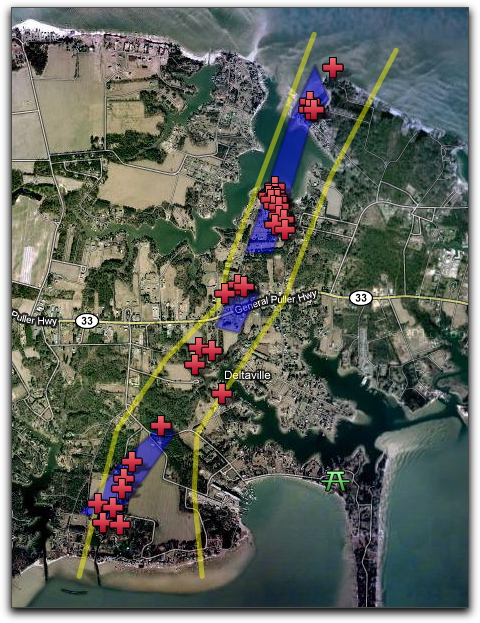
Revised Tornado Path
on Tuesday April 19, 2011 06:05PM
 The Blue Shape is path observed on ground and in WAVY video by Strother Scott. Yellow lines are the edges of the path per Glenn Nix's map in the Southside Sentinel - Red Crosses are "approx" location of destroyed houses marked on the Glenn Nix map. It is very difficult to match up the houses on the map with the Glenn Nix destroyed houses - so please interpret a Red Cross as a "House near the cross was destroyed".
The Google Map can be accessed here